


Feature/Sports
By Bryan Simpkins, 4-2-24
Editor’s note: The author circumnavigated Amelia Island last year in a fast time, considering he was paddling a 13′ plastic sit-on-top kayak. Last week he attempted to do the same with Cumberland Island, but his timing was wrong, so he aborted that voyage. Not to be deterred, he turned right around and paddled around Big Talbot and Little Talbot barrier Islands on Monday, April First (no April Fool joke!). He still has his eye on Cumberland!
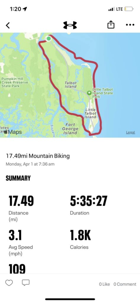
Solo circumnavigation of Big, Little Talbot and Long Islands. Monday April 1st 2024
Prologue
Shortly after circumnavigating Amelia Island last September, 2023, I set my eyes on Cumberland Island. Cumberland is a step up from Amelia. What I mean is there are an additional 12 miles around the island. 18 miles in the ocean with an opposing 2.5 mile Jetty at its south end and then 18 miles of marsh with multiple creeks and tidal areas.
The last week of March, in 2024, I had packed and prepared to circle the Island.
Predicted 5 mph winds changed into 10+ North Northwest head winds and crushed all my plans.
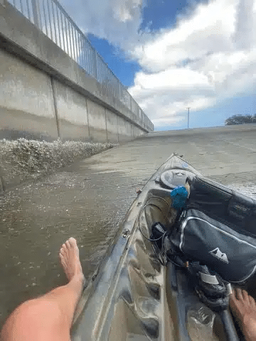
So I set my eyes on the Talbot Islands (Big Talbot & Little Talbot). I already had the kayak equipment bought and packed. I just had to add some fruit and my reliable Crustables (PB&J sandwiches).
Talbots- Here I Come
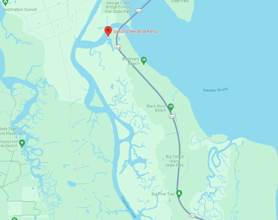
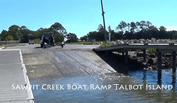
The Florida State Park guide said the Sawpit Creek boat ramp, on Big Talbot Island, opened at 8am. Not bad because low tide was at 8:30am that morning. I arrived at 7am and, to my delight, the gate was already unlocked. This would give me an extra hour of outgoing and by my research, would put me around the north end and traveling clockwise down the ocean side ahead of plan.
I pushed off from the ramp at Sawpit creek, hugged the inside edge as I rode the tide out, crossed under the bridges that connect Big Talbot to Amelia Island, passed boneyard beach on the right, and followed the current out to the giant sandbar separating the ocean from the Nassau River.
As a side note, I tried to read up on any articles about a solo trip around Big & Little Talbot but I could not find any. I did find articles about group trips around either Big or Little Talbot. It’s also important to note that Simpson creek divides the 2 islands and a third, smaller island, Long Island, sits in the middle of the 2. It has a smaller creek (affected by tides) Myrtle Creek, running through them as well. Simpson and Myrtle Creeks make up Long Island.
On the sandbar the sun was starting to warm things up and the offshore winds had not yet awoken. I was expecting them today and hoped to be as far around the island as possible before they arrived. As I approached the turn I could see how the outgoing tide met the ocean and created a lot of surf. It ranged anywhere from 2 to 4 feet. Not huge but enough to swamp a kayak.
With my life vest on, surf leash connected from the kayak to my ankle and another paddle leash attached at the wrist I timed the swells and made it through. For anyone who has had a wave grab the rear of their kayak, you know how that sudden turn can straighten your spine? Well, all I can say is Thank God the surf wasn’t any bigger or the swells any more consistent because my spine was straight for awhile.
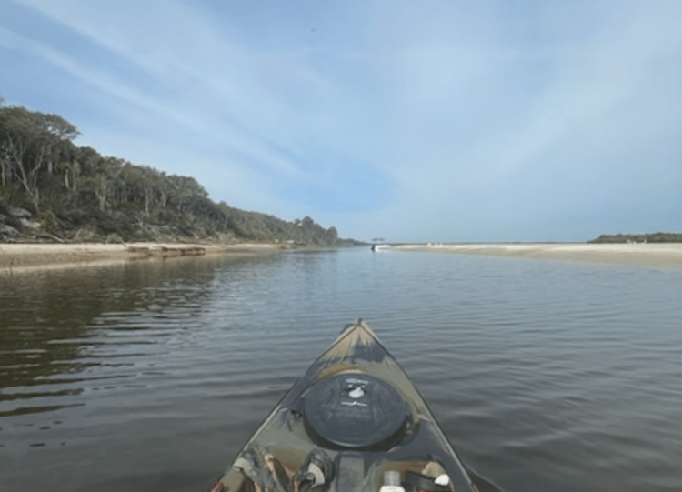
As soon as I paddled around the point everything settled down. A couple of curious sea turtles and groups of wind surfing pelicans kept me amused for the next 5 miles. It’s amazing how loud you can sing when no one else is around. Now the Talbots shoreline looks straight on your map but I found myself having to make constant adjustments to keep fairly close to the beach. Giant sand dunes and twisted oaks and palms held my attention. It is amazing how the wind, over time, can shape things. Except for the rare beach goer I had this whole area to myself for a couple miles.
Eventually I passed the park’s main entrance and the beachgoers increased. A couple of fishermen with 4 or 5 poles each were the only people I saw till I arrived at the south end of the Island.
Up to this point I had only drank one red bull and had one sandwich. The turn into the Fort George inlet was the one area I would like to redo. The beach became very busy with boats, paddle-boarders, vehicles and buildings. From my perspective I could not find the smooth water channel entrance so I thought I could cut through the sandbars and the occasional set wave. Yeah, that’s the part I’d like to do over.
I should’ve traveled south a little more and then done a hard right 90 degree turn….. but I took a few waves over the side and had to beach it so I could dump the water out. You do know that 1 gallon of water weighs 8.8 pounds and 20 gallons weighs 176 pounds. Thats about what my 13.5 foot Prowler Ocean Kayak holds when swamped. You won’t make good time basically dragging another human. That was fine though. I was in a foot of water and I just used the current (the tide was now incoming) to float to the beach. Besides, it was a great time for a protein shake and another sandwich.
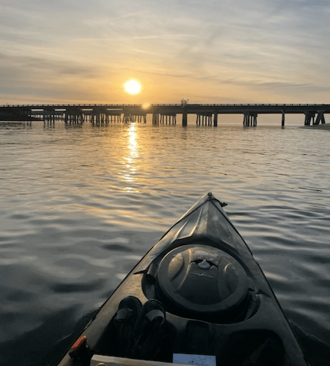
Crossing under the Alimacani Bridge you had better know where you want to be at low tide! Fortunately I am familiar with the area and I have fished from the bridge, so I know to hug the right side of the bridge and stay along the bank until I got past the massive sandbars.
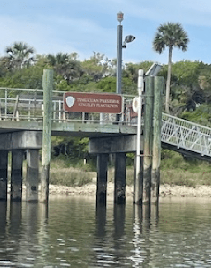
The water turns the color of iced tea as you approach the Timucuan Preserve / Kingsley Plantation area. There were multiple families with their boats anchored along the various sandbars. I didn’t have to worry about wakes from the boats because no one dared to drive fast.
This area will put you at about the 2/3 mark of the trip and it brought a new, umm, ….opportunity. I had never been in this area before and I knew at some point the incoming tide from the other side of the island would meet me. This is where my average speed went from 5 mph to 2.8 mph. It wasn’t bad, it just sucked. I found myself looking for the Intracoastal Waterway, hoping the tide would still be pushing in and help me get a little further before the battle begins.
I didn’t see any wildlife on the backside of the islands, but upon entering the ICW I did see a lot of big yachts. Man, do those guys push some water. Fortunately all but one slowed down and made it pleasant for me. I stopped on some of the dry land occasionally for a photo opportunity but one spot was particularly nice, a muddy beach with some amazing salt dried trees. After a couple pics and some wandering away from the kayak I decided that I’d better shove off again. I did not want the tide to carry my kayak away without me in it. Note: I do have an anchor…. I just didn’t use it there. I should’ve.
My next obstacle is called the “Sunglasses.” Well, I made that up. I don’t know what, if anything, it is called. On the map you will see what I mean. A couple mini islands make it look like a pair of 1950 glasses along the Intercoastal Waterway. The current seems intent on matching me stroke for stroke here. Slow going. At this point I am 5 hours and 15 minutes into the trip. Previous articles about the individual islands set a time of 6 hours as the norm. I did both of them in 5:35 with an average speed of 3.1 mph. 1.8K calories and a distance of 17.49 miles.
Upon reaching the ramp and loading my kayak I was greeted by an officer from Fish & Game. She said I was fairly chipper for someone who just circumnavigated the Talbots. Compliment accepted.
Conclusion
After not being able to hit my original target of Cumberland Island in Georgia I was pleasantly pleased to add this barrier island to my “accomplished” list.
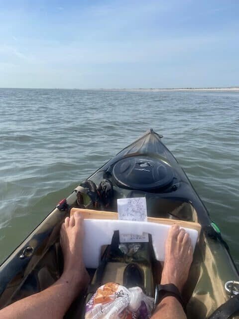
Ocean current was N NE and the winds, when they came up, were SW at 5-10 mph. Water temperature was 64 degrees and air temp was a high of 71 degrees. Gatorade, Crustables, Sugar free red bull, bananas and trail mix were my snacks. Bug spray (for the launch) and sunscreen are a must. A good breathable long sleeve shirt and a hat are recommended. I had printed a map (incase my phone died) and my plotting was spot on except for where the incoming tide met me. In my article about my solo circumnavigation of Amelia island I recommended a pair of gloves. My 240cm fiberglass paddle put some slight blisters on me again. I should’ve wore the gloves I brought.
Thank you for taking the time to read this. I sincerely hope this helps you as you plan your trip…. Or, I hope it encourages you to try the trip. For me, it was good quality time with the Lord and a major accomplishment for someone who has found he likes to push his limits against self & nature.
Bryan Simpkins
Past notable trip:
Editor’s notes: Mr. Simpkins is much too modest. Being a 30+ year paddler myself with quite a few trips under my belt as well, I could readily see that he is a very strong, thinking paddler. To complete the trip in such a good time with a short, slow plastic kayak is quite an accomplishment in itself. To do it utterly alone, without a support crew and co-paddlers is even more difficult. He carefully planned and executed this trip to arrive at all the right points at the right time, tide and currents for maximum performance and safety. There are some tricky waters in the two shallow, rough, treacherous, ever-changing and largely uncharted inlets he navigated.


