


Feature
By Bryan Simpkins, 11-4-23
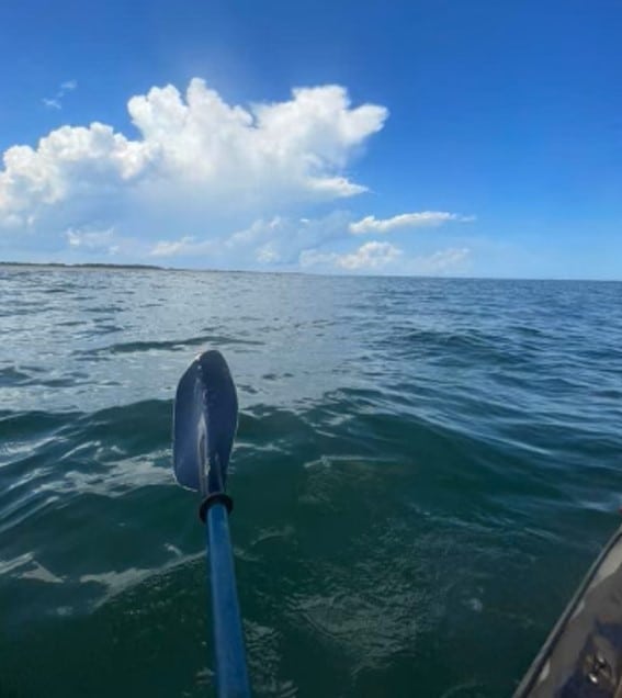
I recently accomplished a bucket list item. A circumnavigation of Amelia island in a 13′ plastic sit-on-top kayak.
Amelia island is the northernmost barrier island in the state of Florida. It is separated from the state of Georgia by the intracoastal waterway, a combination of the Saint Mary’s and Amelia Rivers with the Atlantic Ocean as the eastern boundary.
The currents around the island can be treacherous, especially where the river empties into the ocean at the south end of the island and where the jetties protect the entrance into the northern side.
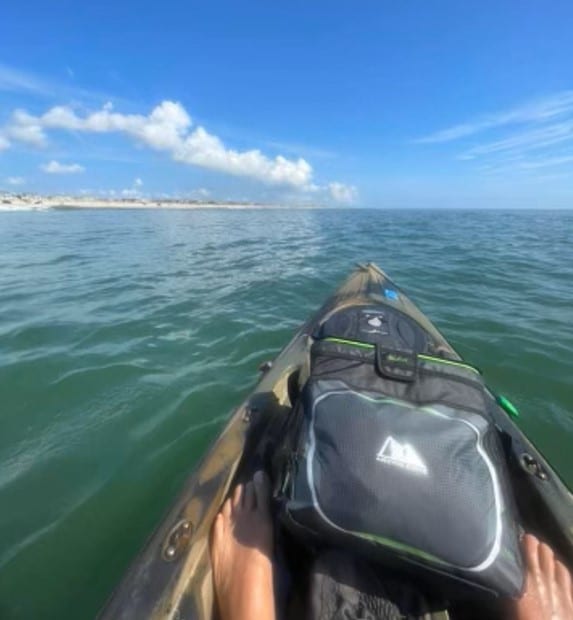
Amelia island is 13.5 miles long and 2.5 miles wide at the widest point. The marsh/river side has many creeks and estuaries which create the need for some intentional planning or you will spend extra time back tracking.
Tides and currents, as well as swell direction, have been a couple of the key reasons I hadn’t attempted this earlier.
On September 11th everything lined up as Hurricane Lee passed by the island. It created a south / southwest swell with a slight breeze going in the same direction.
My kayaking experience usually has me in the backwaters. The local Lofton creek has been my haunt. My good friend Mark Grimes and I have encountered a lot of wildlife, including gators, beavers, snakes and deer, as we’ve navigated the creek from our favorite launching point on A1A. We have explored every waterway and swamp on and around Amelia island.
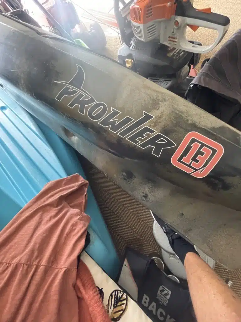
Why is this important to know? I usually tackle these waters in my 10.5 sit on top kayak, equipped with machete, knife, hatchet, clippers and 9mm. I don’t own an ocean kayak. So thank goodness for a friend who does.
I did my due diligence and read articles on others who had made the trek around the island before. I researched how long it should take and what I should carry.
Because I am used to staying longer than I should I’ve learned well what I knew I needed. It really wasn’t a lot and I did have leftovers. But should you want to know for yourself, here is a list. Crustables (yeah the peanut butter and jelly sandwiches). I took 20 of them. Water, Gatorade, Red Bull and some fruit. Other items included a bailing cup, headlamp and navigational red and green running lights, sunscreen, sunglasses, a big hat, battery charger for my phone and some ibuprofen. I should’ve put some gloves on that list.
Launch!
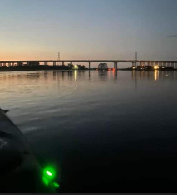
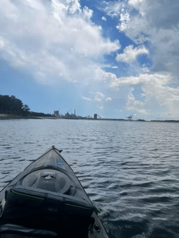
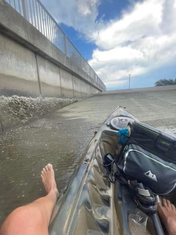
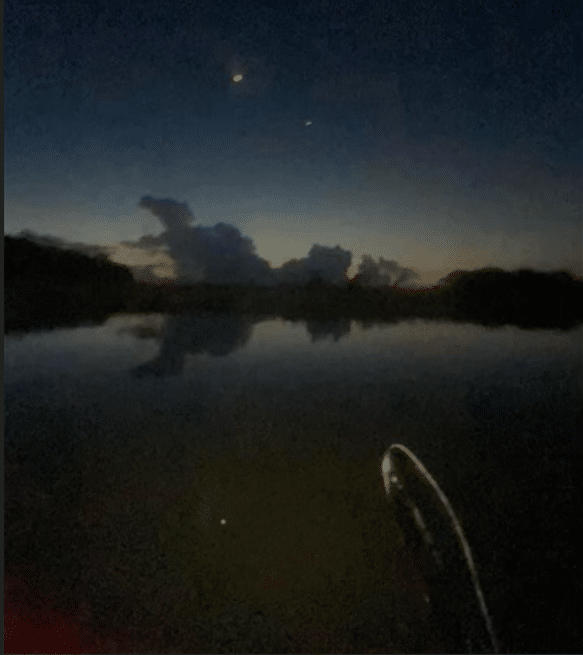
I left Dee Dee Bartels boat ramp, on the northwestern side of the island at 5:00am. 1 1/2 hours of incoming tide got me to, and through, the Shave bridge (SR200/ A1A). This area at the Down Under restaurant is the narrowest and fastest moving water on the whole trip. It was pitch black until this point and as the tide changed the sun arose… a very welcome sight.
I was making great time and I was able to take some great pictures. I navigated the smaller creeks and reach the south end of the island feeling great. This is where a navigational error caused me to take a few waves across the bow and I had to spend some time bailing out the kayak.
Trouble!
A simple course adjustment could’ve saved me from this potential swamping. As I decided to hug the coast I did not allow for the nice swell hurricane Lee was pushing in front of it. The news channel said the waves would come on Friday… but it was Monday.
Watch Facebook “sets” video!
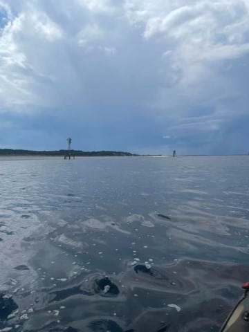
Got the kayak free of water and got back on track. Trying to decide on how far off the coast to stay was also tricky due to the ever shifting sand bars on Amelia. Multiple times, an occasional set would roll through, causing me to adjust and dig! At the halfway point I was sore in the shoulders and the ocean side of the island, 13.5 miles, seemed very long.
Landmark by landmark I inched my way north. Knowing the island well kept my mind from wandering. I knew exactly where I was and how far I had to go.
I also made the occasional text to various people who with I had prearranged check points with.
Somewhere around the 3/4 mark I got a second wind. Now a decision had to be made!
More Trouble!
As you approach the jetties at the north end of the island you have to consider the rebounding waves from the south swell. To me, this was the scariest part of the journey. Besides the towering cumulus clouds and the rain and lightning happening on shore, the waves were coming from every angle. I was on high alert and my life jacket was on!
As I was saying, a decision had to be made. I could either try to land the kayak and drag it a couple hundred feet to the St Mary’s River and risk being dumped by the 6-8 foot waves….. or….. I could paddle out farther into the ocean and look for a break in the jetties.
I chose the latter, almost to my demise! The further out I went the bigger the waves got. Even though they began to consistently come from the south (thank God) they were breaking in deep water. There just didn’t seem to be an end to these giant pieces of granite that comprised the jetty.
I found a spot about a half mile out. It looked consistently open. I watched and timed the rise and fall of the waves. I thought I knew how long I had to paddle through…. The next swell came and I went.
As I bottomed out on the rock, my timing was terrible, I turned to watch the next wave roll across the 13.5 sit-on-top kayak and completely fill it up. Horrified, I recalled that it was about in this spot that many years earlier my scoutmaster, Larry Lannon, had lost his life.
I was thrilled, to say the least, as the kayak lifted and broke free from the jetties! Now on the inside I bailed out the kayak knowing my life depended upon it…. The tide had changed, as I had planned, and the current drove me to Fort Clinch on the northern side of the island. I was almost home.
Even though I couldn’t actually see the people’s faces on the beach I knew what they were thinking. As the massive charter boats were on the run to beat the rain, which now began to lightly fall on my location, they saw a kayak coming in from the ocean and probably wondered what the heck was going on?
Water weighs 8.33 pounds per gallon. The faster I got the water out of the storage areas on the kayak the faster and more stable I began to go.
Home Stretch
I hugged the shoreline passing the tourists and shark teeth hunters at the Fort. I finished my last Gatorade and rounded the corner to see my starting point- the boat ramp. 8 hours and 22 minutes. Exactly 30 miles. Would I have the strength to lift the kayak onto the trailer?
At some point around what the locals call reefer road (due to a shrimp boat crashing on the jetties and dumping tons of marijuana along the coast in the 1970’s) I lost my ability to text or call. One of my friends was concerned about what happened to me since he hadn’t heard from me in quite awhile. Be careful should you decide to do the trip. It is a dead area for the phones.
I saw amazing things along the way. Small sharks, tarpon, I even had a sea turtle hang out alongside me for a bit.
The glare from the early morning sun getting under my glasses was tough for a couple hours. Maybe all those years of sitting on my surfboard, staring at the horizon, trying to position myself for the peak of the next swell softened my eyes? Whatever the reason, it was brutal.
Another thing to consider was the early morning glare of my green starboard light. I purchased the removable LED lights because I knew I would be spending some time in the intercostal waters. The glare made it hard to navigate in the darkness.
Well, I made it. I’d like to thank George Miller for encouraging me to make the trip, write about it and for editing it. Even now I’m planning something for Cumberland island, the southernmost barrier island in Georgia…. And it’s bigger than Amelia.
Bryan Simpkins
Amelia Island resident
2023
Editor’s notes: Mr. Simpkins is much too modest. Being a 30+ year paddler myself with quite a few trips under my belt as well, I could readily see that he is a very strong, thinking paddler. To complete the trip in such a fast time with a short, slow plastic kayak is quite an accomplishment in itself. To do it utterly alone, without a support crew and co-paddlers is even more difficult. He carefully planned and executed this trip to arrive at all the right points at the right time, tide and currents for maximum performance and safety. Catching the post-hurricane coastal tailwind and swell was a nice finishing touch, although it did pose some risks.


